A Ridge Called Misery: Hiking the Misery Ridge Trail in Smith Rock State Park in Oregon

The original plan had been this: Wake up early, make the drive to Smith Rock State Park before the clouds were due to roll in, and take an easy hike along the Crooked River.
And yet, somehow it was two hours into our morning and we were standing at the top of the Misery Ridge trail – the most difficult trail in the park.
So how did we get here?
Well, it's simple, really: my husband, Elliot, is always up for a challenge or adventure, and I can't say no to a great view. Even if it does mean hiking nearly a mile up the side of a mountain.
Smith Rock State Park
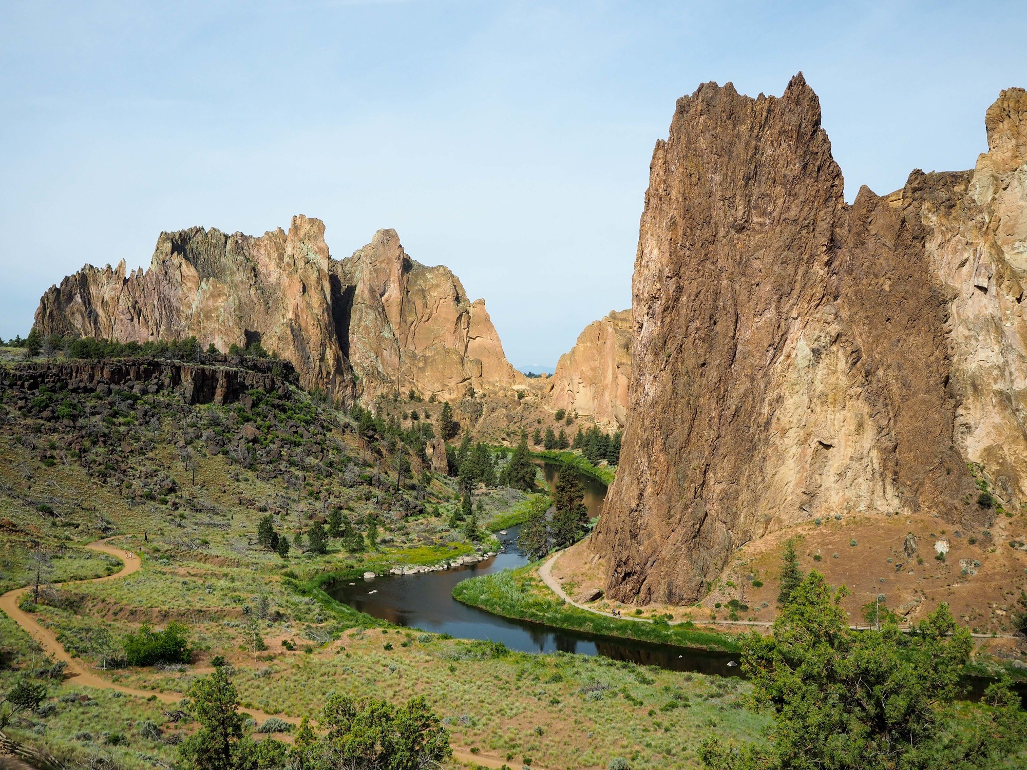
Smith Rock State Park is located in central Oregon's High Desert, near the towns of Terrebone and Redmond, roughly a 40-minute drive from Bend. It's famous for its jagged rock face that rises up to 600 feet above the Crooked River, which lives up to its name as it snakes along the canyon floor.
This may be the first time you're hearing about this state park, but Smith Rock actually has a couple of claims to fame.
First, Smith Rock is a mecca for rock climbers. In fact, it's often considered “the birthplace of modern American sport climbing,” and has more than a thousand bolted climbing routes.
On top of this, several years ago Travel Oregon named Smith Rock one of the 7 Wonders of Oregon.
And since it was super close to where Elliot and I were staying while visiting his sister in Bend as part of a longer Oregon road trip, we couldn't pass up a visit.
But, like I said, our original plan had been to head down into the canyon and take a nice stroll along the 2.2-mile River Trail. This trail is wide and relatively flat (also great for mountain biking), yet still offers up fantastic views of the tuff and basalt cliffs. (And in case you're wondering what “tuff and basalt” are, basically it's hardened volcanic ash and lava! This is volcano country, after all.)
As soon as we got to the upper parking lot near the Rim Rock Trail and had a look down into the canyon and over to Smith Rock itself, though, I had a feeling we were going to be throwing that original plan out the window.
Because the beginning switchbacks of the park's most difficult trail were in plain view. And the trail didn't really look THAT difficult. And I was already imagining what the view from the trail would be like…
Hiking Misery Ridge
By the time we had taken the Canyon Trail down to river level, we'd already decided to just go for it. We had plenty of water and sunscreen with us; I was already wearing my hiking boots; and the sun was hanging out behind a very thin layer of clouds that made it feel a bit less warm.
And so we crossed the bridge over the Crooked River and immediately started up the first switchbacks of the Misery Ridge Trail.
The first set of switchbacks wasn't really that bad, and both of us assumed that the trail would flatten out once we got to the back side of Smith Rock.
But it didn't. The trail continued to go up and up and eventually led to even more switchbacks.
To be fair, I've hiked more “miserable” (i.e. more difficult) trails before. (Angels Landing, with its 1500 feet of elevation gain and half a mile of using fixed chains to scramble up a narrow spine of rock comes to mind.) But since I hadn't really prepared for this hike, I found myself needing to stop more often on the switchbacks than I would have liked.
But I just pretended to be taking lots of photos. (That's the secret, my fellow non-hiker folks.)
We eventually made it the 700 feet up to the top of Misery Ridge, where you do get amazing views out over the canyon and nearby rock formations.
From here, we headed across the top of the ridge to the parts you can't see from the parking lot or canyon floor. Namely: Monkey Face!
This rock column is named for the fact that the top kind of looks like the face of a monkey. Climbers are common here, and you can sometimes even see slackliners. We stopped for a while to watch, and to enjoy the views out over the high desert.
On clear days you can see the peaks of the Cascade Mountains in the distance.
Then it was time to make the trek down the back side of Smith Rock. Be careful here, as the trail (which goes down to the right from the Monkey Face viewpoint) is extremely steep and covered in loose rock/sand. Even with good hiking boots I was slipping all over the place!
We soon met up with the Mesa Verde Trail at the base of Monkey Face, and continued downhill to the left until the trail merged with the flat River Trail. (Yay no more climbing!)
We followed the River Trail back around to the front side of Smith Rock, stopping briefly to dip our hands into the Crooked River and to watch lots of climbers tackling routes up the red and orange rocks.
Our total hike was just under 4 miles and took us a little over 2 hours total (and that was with plenty of stops!).
Afterwards, we headed back to the car and rewarded ourselves with lunch at Terrebone Depot, a restaurant in an old train station just a few minutes from Smith Rock. (Try the buffalo nachos!)
Tips for hiking at Smith Rock
Think you might like to take a hike at Smith Rock State Park? Well here are some things to know:
- There's a day use / parking fee of $5, which you pay when you enter the main parking lot.
- You can bring pets into the park (even up Misery Ridge!), but they do need to stay on a leash.
- Make sure to have the proper gear. Smith Rock is located in the high desert, meaning it can get dry and hot in the summer. Be sure to have plenty of water, along with sunscreen and a hat.
- If you're hiking Misery Ridge, have good shoes. The trail is steep and slippery in many parts. My Merrell Moabs did well for me.
If it's really hot and sunny when you start your Misery Ridge hike, I recommend doing the hike in reverse – head left after the bridge, and start the hike on the River Trail. This way you'll go up the switchbacks on the back of Smith Rock (near Monkey Face), keeping you out of the direct sunlight on the most difficult part of the hike (i.e. the “up” part).
And if you don't want to hike Misery Ridge? There are plenty of other easier trails to choose from, many of which still have great views of the surrounding landscape and climbers. Check out the Smith Rock trail guide here.
READ NEXT: The Perfect 10-Day Road Trip Itinerary for Oregon in Summer
Have you heard of Smith Rock before? Is it someplace you'd like to take a hike?
Pin it for later:


Amanda Williams is the award-winning blogger behind A Dangerous Business Travel Blog. She has traveled to more than 60 countries on 6 continents from her home base in Ohio, specializing in experiential and thoughtful travel through the US, Europe, and rest of the world. Amanda only shares tips based on her personal experiences and places she's actually traveled!


Hey Amanda,
Hiking Misery Ridge looks challenging!! But looking at the photos the view and everything looks worth it. Great job and thanks for sharing the tips it would be very helpful if ever we plan to hike Misery Ridge 🙂
Worth it for sure, especially if you hit a nice day like we did.
Misery Ridge doesn’t look miserable at all. What incredible pics, they really give you a feel of the landscape and convey how high you climb. I look forward to doing this trail at a steady pace so I can enjoy those views.
I’ve done much more miserable hikes, for sure! And the views are definitely worth it.
Thanks for the post and tips, Amanda! I’m heading to Oregon two weeks later, and your post is really helpful! Just a friendly reminder: you haven’t painted Oregon state red in your travel map. =)
I hope you enjoy Oregon! And yes, I need to update my US map! (I’m currently on a road trip through a bunch of northern states, so I’ll definitely be updating it after this!)
Just finished hiking Misery Ridge. Read your “story” while we rested at the top. A little tougher than we expected. THEN we saw the sign at the bottom that says “most difficult”. Oops! Beautiful views!!! Definitely worth it. Go early, though. We started at 10:30 am and it was a bit hot on the last half!
Glad you still thought it was worth it! So did I. 🙂